District of Ampara is located in south east of Sri Lanka and belongs to Eastern Province. Ampara District covers area of 4415 sq Km and according to the 2012 statistics the population iss 648,000. 43% of the Ampara District Population are Sinhalese, 38% are Sri Lankan Muslims and 17% are Sri Lankan Tamils. District of Ampara consist of 20 Divisional Districts, 503 Grama Niladhari Divisions and 4 Electoral Districts.
In early days the area of Ampara also known as Digamadulla . This is one of the major paddy producing district in Sri Lanka, visitors can see cascading paddy fields extend up to the horizon. This area gets rain mainly during the North East monsoon and used to store rainwater in tanks so they can have water for irrigation purposes throughout the year.
The temperature of Ampra District vary from lowest value of 24 C to 36C. The average temperature is around 30C. December and January are the coldest months. Average Rainfall Ampara 1400 mm. March to September is the dry season and rainy period is from October to February.
Arugam bay
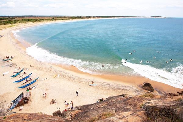
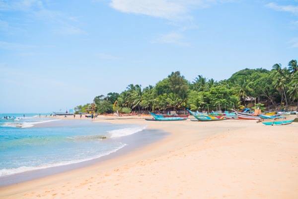

Famous for its surfing, Arugam Bay offers much to tempt even those who are not keen to ride the waves. With its laid- back atmosphere and rustic beachside huts, the village is a haven for holyday makers on the East Coast. Arugam Bayvillage is largely made up of one main street that runs parallel to the beach and is lined with restaurant, guesthouses and surf shops. The ideal time to surf here is between May to October. In the low season, which extends from November to April, many businesses remain closed and it can get very quiet around the village. The south end of the beach is usually strewn with blue fishing boats and colorful nets, marking the tiny fishing settlement of Ulla. Note that this end of the beach is the safest for swimming in season.
The 2004 tsunami brought a lot of damage to Arugam Bay. There has been extensive renovation work since then with an aim to promote Arugam Bay as a mainstream tourist destination, while also improving the infrastructure required to reach here. However, the locals fear that such tourism developments might alter the atmosphere and the unique character of the village.
Lahugala National Park
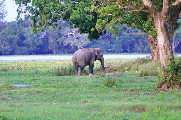
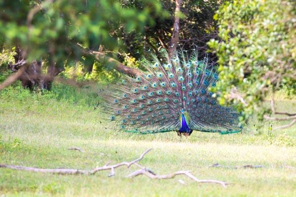
Located within easy reach of Arugam Bay, this small national park offers the chance to see a wide range of aquatic birds as well as elephants. Of the three reservoirs here, the Lahugala Tank is a good place to spot storks and pelicans. During the dry season, herds of elephants congregate at the tank to eat the beru grass, which grows in profusion around the water.
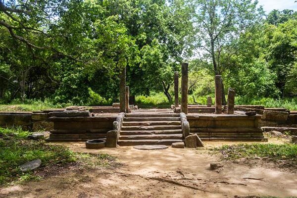
Environs: The evocative ruins of Magul Maha Viharaare situated 6 km southwest of the park. Inscription found at the site confirm that the monastery complex was built by King Dhatusena in the 5th century. Only a small section of the complex has been excavated while the rest is still covered in thick jungle; look out for the dagoba, the image house and the well-preserved moonstone ringed with elephants and their mahouts.
Kudumbigala Hermitage
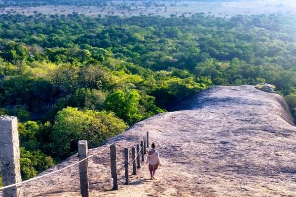
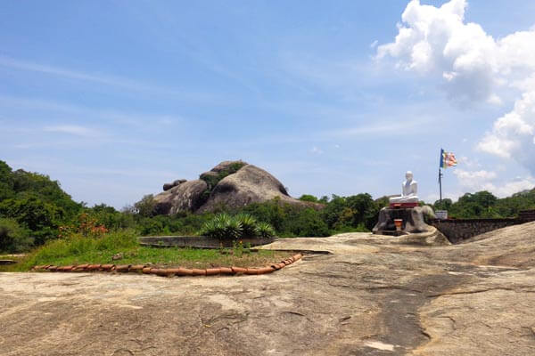
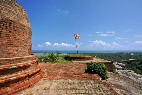
Hidden away among thick jungle, the beautiful forest hermitage of Kudumbigala is a tranquil and atmospheric spot. Spread over an expanse of 47-sq km, the hermitage consists of hundreds of shrines set in rock caves, some of which contain inscriptions in Brahmi. The site is said to date back to the 2nd century and was originally established as a refuge for Buddhist monks seeking isolation and a life of meditation. It is still visited by monks who come here to meditate. The summit of the highest rock, crowned by a cylindrical dagoba, offers breathtaking views across the lush landscape. The summit is reached by a flight of rock-cut steps.
Ampara District is one of the 25 districts of Sri Lanka, the second level administrative division of the country. The district is administered by a District Secretariat headed by a District Secretary appointed by the central government of Sri Lanka. The capital of the district is the town of Ampara.