The Nuwara Eliya district presents a picturesque landscape and a temperate climate that is unlike anywhere else in the island. The British found the town of Nuwara Eliya during the colonial era and many buildings in the region have retained their colonial architecture to this date. The name Nuwara Eliya means ‘the city of lights’, a quite fitting name to the town that is nestled amongst peak. Located at an altitude of 1000m-2500m above the sea level and a mean annual temperature of 160C, the district thrives on a significantly cooler climate than the lowlands of Sri Lanka. However, the temperature in this part of the island is volatile, sometimes reaching as low as 30C towards December and January.
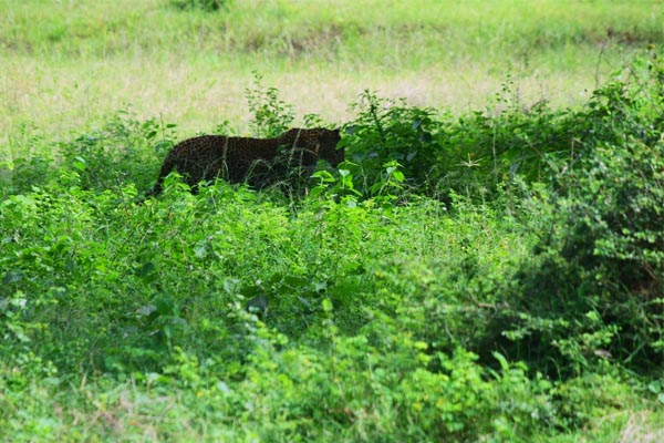
The vegetation in the district, which has adopted to these unique climate conditions range from sub-montane forests to the scenic grasslands of Horton Plains, Moon Plains, seethaeliya and Elk plains. An extraordinary array of fauna thrives in these environments including endangered species such as the western-purple-faced langur, the Horton Plains slender loris and the Sri Lankan leopard. Nuwara Eliya attracts countless birdwatchers seeking to catch a glimpse of both endemic highland birds and rare migratory species. The region is considered a biodiversity hotspot and is recognized as a UNESCO World Heritage Site.
The slow-growing tea bushes of this highland region produce some of the world’s finest tea, and is considered to be the most important location for tea production in Sri Lanka. Farmlands with widespread rows of vegetables, fruits and flowers are a common sight in the country-side of the district, and plays a vital part in revitalizing the local economy. The Nuwara Eliya district transforms into a festive allure during the warm month of April. This season is marked by mesmerizing flower exhibitions, horse racing and motor racing events, music festivals, shopping festivals, and golf tournaments. The peak of this spring season attracts an extensive mass of local and foreign travelers.
Nuwara Eliya
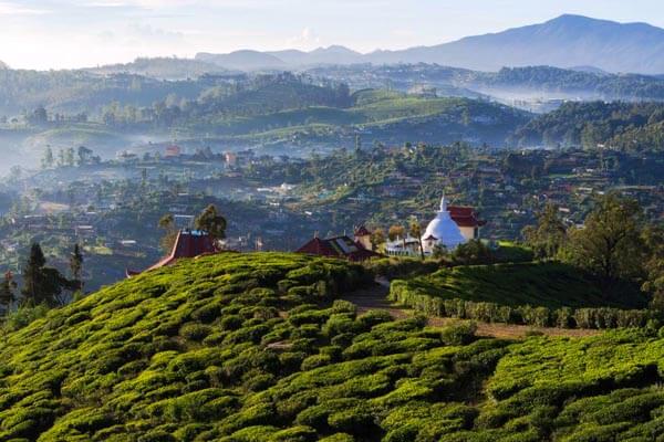
Established by the British in the 19th century, Nuwara Eliya is often referred to as Sri Lanka’s “Little England”. Set in a wooded valley beneath the 2,524-m Pidurutalagala or Mount Pedro, the tallest peak in the country, it is the highest town on the island. With the cool through unpredictable climate, the town provides a welcome relief from the hot and humid lowlands.
The popular town becomes particularly busy in April during the Sinhalese and Tamil New Year holiday, when Sri Lankans flock here in droves. A festive atmosphere prevails during this period- many horse- and motor-racing events are organized and stalls line the streets- and accommodation prices tend to be higher.
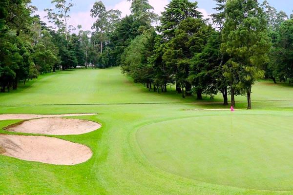
Walking around is a good way to see a number of sights. In the town center is the well-maintained 18-hole Golf Club, which was founded in 1889. Behind the Club House are the remains of a British Cemetery. Where the infamous elephant hunter Major Thomas William Rogers is buried. Also in the town center is the pink Colonial-era post office with a conical clock tower. Nearby, the charming Victoria Park offers some excellent bird-watching; and also has a play area for children near the entrance. A little further on, there is an interesting covered market on New Bazaar Street, where vendors sell a wealth of fruit and vegetables as well as meat and fish.
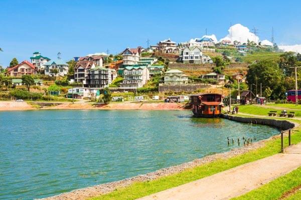
Nuwara Eliya also retains some elegant Colonial-era hotels such as the hill club and half-timbered Grand Hotel, located further north along the Grand Hotel Road. Visitors can go in for a drink, or simply admire the period exterior and colorful flower gardens. To the east of the center stands the Anglican Holy Trinity Church. Built in 1825, the church still holds regular services. Further east lies Lake Gregory. The landscaped area around it is a pleasant spot for a stroll. An on-site boat house rents out pleasure boats or pedaloes for a ride across the lake. The racecourse is located south of the town.
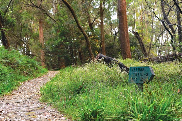
The surrounding countryside offer some excellent walks. The shortest and easiest of there is a 2-km walk southwest to Single Tree Hill, from there is panoramic vistas of Nuwara Eliya. For an extended, day-long hike, walk 4 km north from Single Tree Hill through tea plantations to the isolated settlement of Shandipura, the island’s highest village. From here, continue southwest to the viewpoint at Uda Radella, for sweeping views south to Adam’s Peak. It is advisable to hire a guide for this walk.
Horton Plains National Park and World’s End
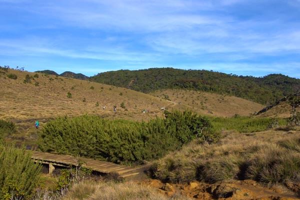
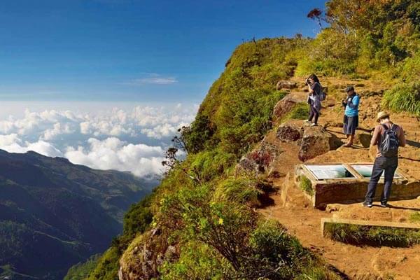
Set in central highlands of Sri Lanka, Horton Plains is unlike any other place in the country and is often compared to the Scottish highlands, for its windswept landscape and cool, wet climate. It is named after Sir Robert Wilmot- Horton, the British Governor of Ceylon from 1831 to 1837. Formerly a wildlife sanctuary, the area was declared a national park in 1988. At an elevation of over 2,000 m, the park is situated on the highest plateau in Sri Lanka, with its terrain characterized by undulating grasslands interspersed with dense cloud forests, rocky outcrops and waterfalls. Home to a wide variety of wildlife, Horton Plains also boasts a large number of bird species. However, the key attraction in the park is World’s End, a sheer precipice affording panoramic views across the southern part of the island.
Unlike other national parks in Sri Lanka, Horton Plains can be explored on foot and without a guide, provided visitors stick to the market trails. While there are several trails in the park, the majority of people follow the Loop Trail. It is possible to head in the direction of either World’s End or Baker’s Falls. Although the most choose to go to World’s end first, the last stretch of this trail between Baker’s Falls and the entrance is an open grassland with no shade. It is advisable to wear good walking shoes as the paths are rocky and uneven. The best time to visit the park is early in the morning, around 7am, to allow plenty of time to reach World’s end before 10am, when clouds roll in and the view is obscured from the escarpment. Avoid visiting the park on weekends and public holidays as it can be very busy and noisy. Although the park can be chilly in the morning, it warms up quickly, so bring a hat and sunscreen.
Gallway’s Land National Park
Situated at the heart of Nuwara Eliya, along the road towards Udupussellawa, lies the tranquil Galway’s Land National Park. History unveils that Colonel Galway, who arrived in Sri Lanka (then Ceylon) in the 19th Century, was presented with this land for cultivation purposes. Yet, after seeing the beauty that enthralled its surroundings, Galway did not disrupt a single inch of the natural forest. Before leaving the country in 1938, the only request made by Galway to the then Governor was to protect the land “for the sake of unknown generations of Ceylonese to come.” The land of Galway was declared a sanctuary in 1938 and named Galway’s Land Sanctuary in honor of the Colonel.
Declared a national park in 2006, Galway’s Land is Sri Lanka’s newest national park. Considered a popular bird-watching site, the park is home to over 20 species of endemic birds such as the Dull-blue flycatcher and the Grey-headed canary flycatcher, as well as migratory birds such as the Kashmir flycatcher. The 140-acre park is a haven for naturalists and bird enthusiasts. For the ordinary, traveler, a mere stroll through the lush green park with trees and flowers blossoming in abundance, is a rewarding experience by itself. At a time when natural forests are fast declining due to urbanization and deforestation, it is the duty of all responsible travelers to preserve the integrity of this natural park, just as Colonel Galway did, more than a century ago.
MOON PLAINS
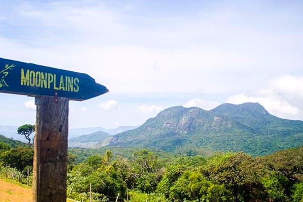
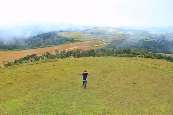
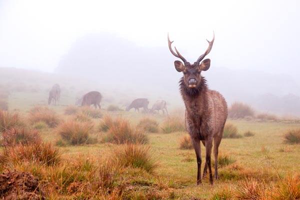
Locally referred to as ‘Sandathenna’, the Moon plains are located in central Nuwara Eliya. Nestled 6,200 feet above sea level, the main attraction of Moon plains is the mini world’s end, which offers visitors a remarkable 360-degree view of surrounding mountain ranges, including Pidurutalagala (8,281ft), Single Tree (6,890 ft) kikiliyamana (7,339 ft), Great Western (7,257ft), conical Hill (7.116 ft ) kirigalpoththa (7.835 ft), Thotupola (7,737 ft), Hakgala (7, 110 ft), and Namunukula (6, 667 ft). This spectacular view complements the winsome ambience of the expansive grassland. Elk, wild buffaloes, deer and even leopards are known to traverse these plains at early hours of the morning.
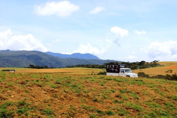
Access to the plain is granted from the Seetha eliya farm, where specially authorized safari jeeps are available for hire, to travel the 3-kilometre distance up until the mini world’s end viewing point. Visitors are allowed into the plains rom 7.30 AM until 5.00 PM every day. Surrounded by cloud forests, tea estates and a unique diversity of flora and fauna, the Moon Plains consists of similar characteristics to that of Horton Plains. Nevertheless, unlike the excursion to Horton Plains, which takes 6 to 8 hours, the trek along Moon Plains can be completed within 2 hours.
Strawberry Model Plantations
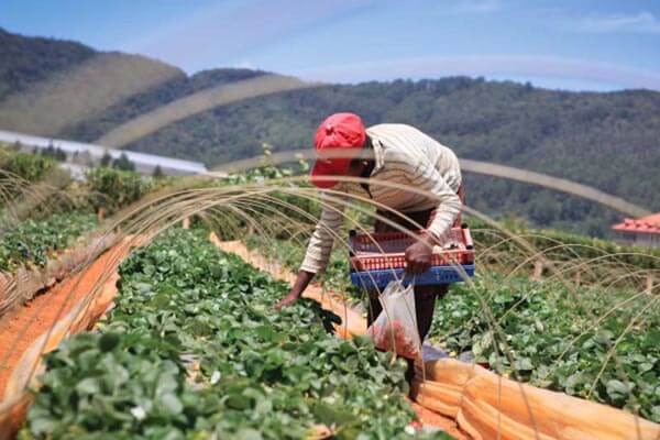
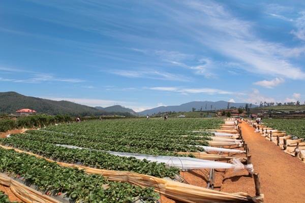

Agriculture is the main source of income-generation for the majority of residents in Nuwara Eliya. It is common to witness the front gardens of most households speckled with fresh vegetables such as leeks, beetroot, cabbage, carrot and potatoes. The mild and pleasant climate of Nuwara Eliya complements the growth of many exotic plants and fruits among which strawberries take precedence. A number of model strawberry plantations and greenhouse can be found across the district of Nuwara Eliya.
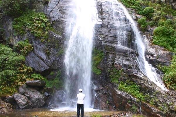
DUNSINANE FALLS
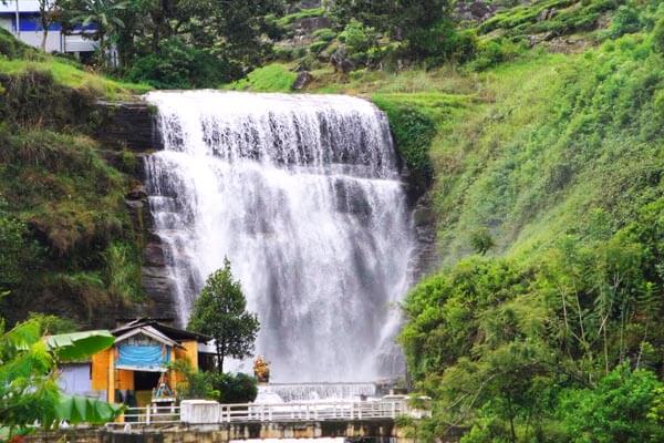
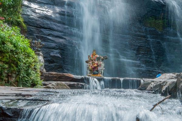
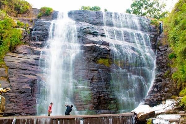
Located between two picturesque tea estates, the Sheen estate on one end, and the Dunsinane estate on the other, the Dunsinane waterfall is simply another gift of nature. In recognition of the two the estates on either side, the waterfall are identified simultaneously as Dunsinane falls and Sheen falls. It is also referred to as pudalu oya falls, in representation of the river from which the waterfall originates. The Pudalu oya commences its journey from the Great Western mountain range, garners several streams on its way down, forms the sizzling Dunsinane falls and finally embraces the sparkling Kotmale oya en-route to the Kotmale reservoir.
The Dunsinane Falls is 330 feet in height and cascades in two segments bisected by a road bridge. The top segment that is visible to that public falls over a wide rocky ledge creating a 30-meter drop. The lower half, which is approximately 70 meters in height, lies hidden below the bridge. This lower segment is attached to the Kotmale power plant, and cannot be accessed for sightseeing purposes. Nevertheless, the beauty of this waterfall is second to no other. At a distance, the Dunsinane falls resembles the veil of a bride as it cascades innocently along a steep incline. The Hindu temple located on the left of the waterfall adds a spiritual undertone to this truly scenic atmosphere.
Mandaram Nuwara
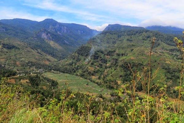
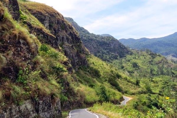
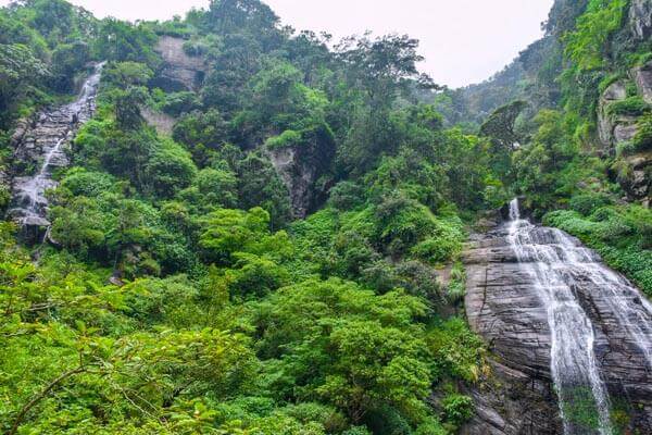
The Mandaram Nuwara basin can be reached via Kandy on the road leading towards Walapane, passing Rikillagaskada, turning right just before the town of Padiyapelalla. The road along this hilly terrain turns and twirls its way through a series of captivating views. With grasslands wreathed with wild flowers of different hues, cascading waterfalls and extensive paddy fields, the scenery is simply breathtaking. Bordering the Piduruthalagala forest reserve, at the base of the massif is a small village, enclosed from the west by Piduruthalagala and from the east by the Balagolla mountain ranges. Due to its high altitude the village receives rain throughout the year. People here have simple lifestyles, centred around the village’s Buddhist temple; their main livelihood being paddy cultivation. Apart from paddy, other crops of vegetables and fruits are also cultivated. The inhabitants of the Mandaram Nuwara village are charming, friendly and hospitable. Finding an honest companion to assist in trekking through the wilderness will not be a difficult task.
The surrounding jungle is teeming with wildlife, from the elusive leopard, the scurrying barking deer to the swinging langurs and macaques. At night the cold air is filled with the loud croaks of amphibians and the never ending rattling of crickets. A wide variety of bird species such as the hill mynah, black eagle, grey hornbill, yellow-fronted barbet and wood pigeon preside over elevated tree-barks and shrubs. Mandaram Nuwara is the ideal location to experience the tranquility of nature at its fullest.
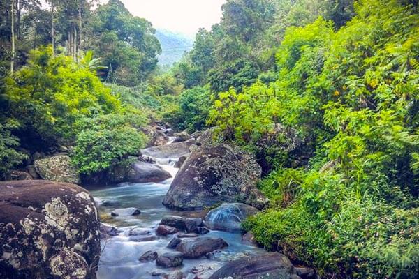
KOLAPATHANA ELLA
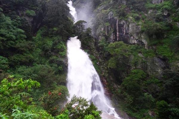
In order to reach the Kolapathana waterfall from Mandaram Nuwara, one must travel 500 meters towards the Uduwela central college, up until an old tea factory. From here, continue on the concrete laid road for a further 500 meters and turn right from the junction towards a dead-end road. Lorries collecting vegetables from farmers travel up to this point. From here onwards, travelers must venture on a hike of 2 kilometers along unmapped footpaths to get a much-anticipated glimpse of the Kolapathana ella. Originating from the Piduruthalagala sight to witness after long and arduous trek.
The Kolapathana ella is literally unheard of, as it is not even listed on the Lanka Council on waterfalls (LCWF) database. To access this waterfall, a guide from the Mandaram Nuwara area is essential, as it would be too easy to get lost in the forest without clear directions.
KOTMALE MAHAWELI MAHA SEYA
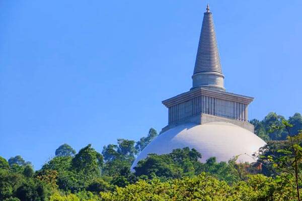
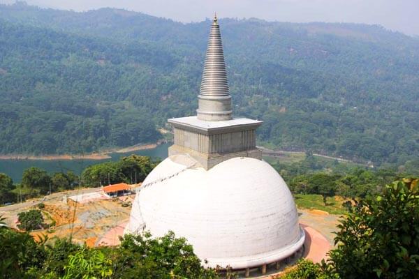
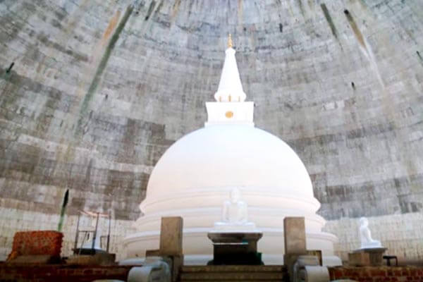
A stunning white stupa is quite a contradictory sight to encounter next to a large reservoir. The magnificent stupa, which is only second in height to the Ruwanweli Maha Seya in Anuradhapura, is the brain child of former Minister Gamini Dissanayake. The stupa was built most importantly to compensate the loss of many temples and properties submerged during the construction of the Kotmale reservoir. Most of the shrines including the Thispane viharaya, Morape devalaya, Othalawa viharaya, Pattini devalaya and Madagoda viharaya were completely submerged by the Mahaweli Development Project. Rare sights of these ruins can still be spotted when water levels recede.
Although the construction of the stupa was initiated in the early 1980s, the completion reached its target only in June 2016; thirty years after the foundation stone was laid. The stupa may not have a strict ascetic depiction; however the atmosphere of the Seya highlights elements of tranquility. Travelers looking for a brief escape from the frenzied pace of day-to-day life can revitalize themselves by taking a stroll around the majestic Kotmale Mahaweli Maha Seya.
Nuwara Eliya is a city in the tea country hills of central Sri Lanka. The naturally landscaped Hakgala Botanical Gardens displays roses and tree ferns, and shelters monkeys and blue magpies.